Have you ever wondered how you can find BLM (Bureau of Land Management) lands close to you for your outdoor activities? BLM lands, managed by the U.S. Department of the Interior, offer countless recreation opportunities, from camping to hunting.
This article guides you in locating these public spaces across various states using resources such as maps and local offices. So, let’s embark on this journey to familiarize ourselves with these terrains that await us!
Key Takeaways
- BLM lands are public areas the U.S. Department of the Interior manages for outdoor activities like camping and hiking.
- You can find nearby BLM lands using the official website, maps, and local offices.
- Different recreational activities are possible on these lands, including developed campsites and dispersed camping areas.
- Know about any permits, fees, or limitations before visiting a specific location.
- If you see something suspicious happening on BLM land, it should be reported to help keep everyone safe.
Understanding BLM Lands
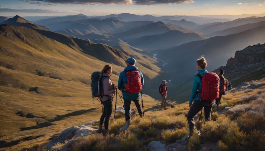
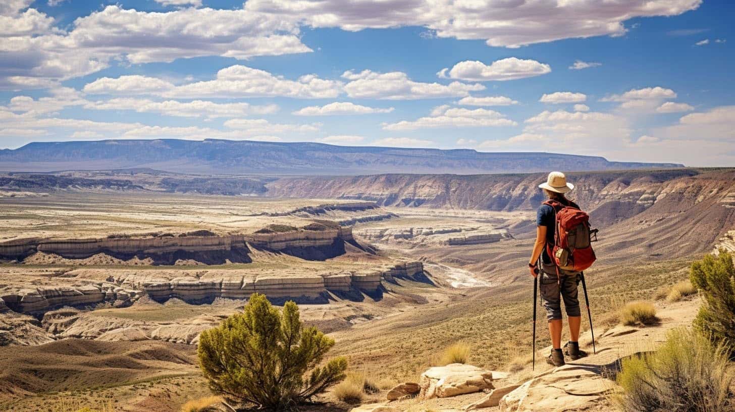
The Bureau of Land Management (BLM), an agency within the U.S. Department of the Interior, oversees a vast expanse of public lands. BLM lands make up about one-eighth of America’s landmass, facilitating outdoor activities like camping, climbing, hiking, and even hunting.
These territories are explore-friendly terrain for off-highway vehicles and mountain biking enthusiasts as well.
Open to everyone, these lands often serve environmental conservation purposes; they protect national monuments and help conserve wildlife habitat and clean water while supporting sustainable grazing and timber harvests, too.
Leveraging geospatial technology products from their program arm or utilizing interactive maps online makes navigating around them easier for first-time visitors. BLM strives to manage such diverse tasks effectively in several regions across the United States, including Alaska and Arizona, adopting laws and regulations underlining their commitment to land stewardship.
Understanding BLM Land Distribution
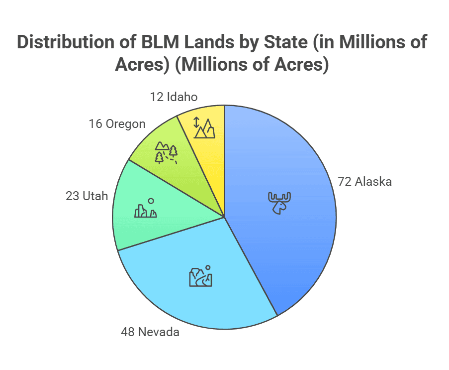
BLM manages approximately 245 million acres of public lands, primarily concentrated in 12 western states. The agency oversees nearly 1/10th of America’s landmass, making it the largest land manager in the United States. These lands span diverse terrains, from desert landscapes to alpine forests.
Western State Distribution
BLM lands are predominantly found in:
- Alaska: 72 million acres
- Nevada: 48 million acres
- Utah: 23 million acres
- Oregon: 16 million acres
- Idaho: 12 million acres
- Other western states, including Arizona, California, Colorado, Montana, New Mexico, Washington, and Wyoming
Types of BLM Lands
Designated Areas
- Wilderness Areas: Protected lands with minimal human impact
- Recreation Areas: Developed sites for specific activities
- Conservation Lands: Areas preserved for ecological value
- Multiple Use Zones: Lands managed for various purposes
Wilderness Areas
These are the most protected BLM lands, characterized by:
- Minimal human impact
- No motorized vehicles allowed
- Limited development
- Primitive recreation opportunities
Recreation Areas
These developed sites offer:
- Designated camping areas
- Trail systems
- Day-use facilities
- Interpretive programs
Conservation Lands
These areas focus on:
- Wildlife habitat protection
- Cultural resource preservation
- Scientific research
- Limited recreational use
Digital Navigation Tools
Interactive Mapping Platforms
Modern technology has transformed how we locate and navigate BLM lands. Several reliable platforms offer specialized features for public land exploration:
| Platform | Key Features | Offline Capability |
|---|---|---|
| OnX Maps | Land ownership layers, waypoint marking | Yes |
| Gaia GPS | Topographic overlays, trail data | Yes |
| FreeRoam | Cellular coverage maps, user reviews | Partial |
Official BLM Resources
The BLM Navigator system provides authoritative land ownership data through a Geographic Information System (GIS) interface. This tool offers:
- Real-time land status information
- Detailed property boundaries
- Recreation site locations
- Road and trail networks
Mobile Applications
For field navigation, specialized apps provide enhanced functionality:
| Feature | Free Apps | Premium Options |
|---|---|---|
| Offline Maps | Avenza Maps | OnX, Gaia GPS |
| Land Boundaries | FreeRoam | Huntwise |
| Campsite Reviews | The Dyrt | Campendium Pro |
These tools complement the traditional methods of finding BLM lands and provide additional layers of information for planning your visit.
Locating BLM Lands: Step-by-Step Guide
Using the Official BLM Navigator
- Visit the BLM GIS Data website
- Select your state of interest from the map
- Enable the “Land Status” layer in the legend
- Use the search function to find specific areas
- Click on colored areas to view land ownership details
Mobile Navigation Process
- Download your preferred mapping app
- Enable the public lands layer
- Look for the BLM color designation (typically yellow)
- Save offline maps of your intended area
- Mark potential access points and campsites
Recreational Activities on BLM Lands

Discover a wealth of outdoor adventures on BLM lands, from camping and climbing to e-biking, hiking, and more; uncover the delightful details ahead.
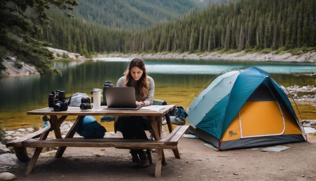
Camping on Public Lands
Public lands offer numerous camping opportunities for nature enthusiasts. Managed by the Bureau of Land Management (BLM), these properties range from developed campgrounds to dispersed camping areas, each with its unique charms.
Developed campgrounds come equipped with numerous amenities such as restrooms, water access, picnic areas, and even electricity in some cases – perfect for those who prefer not to entirely rough it.
Undoubtedly, Dispersed Camping offers a different thrill altogether– an escape into the remote wilderness away from populated sites or facilities. This allows more adventurous individuals to completely immerse themselves in the raw beauty of nature while adhering to specific rules and regulations set forth by the BLM.
These include restricting stays at one location not exceeding 14 days within a 28-day period, ensuring camps are established far enough distance from water sources, and making certain that no trace is left behind after departure.
Developed Campgrounds
Developed campgrounds on BLM lands offer a variety of amenities for camping enthusiasts. Amenities such as restrooms, water supply, electricity, and picnic areas make camping easier and more comfortable.
These sites also feature tent pads to ensure your shelter is safely secured overnight. For larger gatherings or any social event in nature, these developed campgrounds provide group shelters as well.
The BLM manages these spaces with precision and careful planning to cater to beginner campers needing modern comforts or experienced ones seeking an easy outdoor stay. From the convenience of being close to facilities like restrooms and running water down to designated fire pits for safe cooking, developed campground stays invite those who prefer orderly in their wilderness experience.
Dispersed Camping
Dispersed camping on Bureau of Land Management (BLM) lands is a unique experience for outdoor enthusiasts who prefer solitude and the raw beauty of nature.
To encourage responsible use, the BLM limits dispersed camping to 14 days within a 28-day period. This practice promotes environmental sensitivity while offering adventurers an unparalleled love affair with America’s public lands.
These natural jewels stretch across states from Alaska to Wyoming, promising off-the-beaten-path sites amidst breathtaking landscapes accessible through BLM Recreation Opportunities’ Interactive Map.
Regardless of whether you’re mountain biking in Utah or hiking in Oregon, securing your next celestial stargazing hideaway has never been easier: just visit BLM.gov and click away!
Permits, Fees, and Limitations on BLM Lands
Maintaining the safety and integrity of BLM lands requires vigilant community participation.
When visitors encounter illegal activities such as vandalism, resource theft, or unauthorized vehicle use, prompt reporting helps protect these valuable public lands for future generations.
The Bureau of Land Management relies on public assistance to monitor and preserve over 245 million acres, making every visitor an essential partner in land stewardship.
Required Documentation
| Activity Type | Permit Required | Duration | Cost |
|---|---|---|---|
| Dispersed Camping | None | 14 days max per site | Free |
| Developed Campgrounds | Recreation Use Permit | Per night | $0-20 |
| Special Events | Special Recreation Permit | Event duration | Varies |
| Commercial Activities | Commercial Use Permit | Annual | Based on group size |
Common Limitations
- 14-day stay limit within any 28-day period
- Group size restrictions at specific sites
- Seasonal closures for wildlife protection
- Fire restrictions during high-risk periods
- Vehicle access limitations in sensitive areas
Area-Specific Requirements
- Some areas require advance reservations
- Designated sites may have additional fees
- Special permits needed for specific activities like:
- Rock collecting
- Commercial photography
- Organized group events
- Research activities
Conservation Restrictions
- No ground disturbance allowed
- Pack-in, pack-out requirement
- Minimum distance from water sources
- Protected species habitat restrictions
- Cultural site preservation rules
Reporting Crimes on BLM Lands
Safety is paramount for everyone accessing public lands managed by the Bureau of Land Management (BLM). Therefore, if you witness a crime or any suspicious activity on these lands, it is important to report such instances promptly.
When to Report
- Criminal activity in progress
- Environmental damage
- Resource theft or vandalism
- Illegal dumping
- Unauthorized vehicle use
How to Report
| Situation | Action | Response Time |
|---|---|---|
| Emergency | Call 911 | Immediate |
| Non-Emergency | Contact Local BLM Office | 24-48 hours |
| Resource Damage | BLM Law Enforcement | 1-3 days |
Required Information
- Exact location or GPS coordinates
- Description of incident
- Date and time
- Vehicle descriptions if applicable
- Photos or video (if safe to obtain)
- Suspect descriptions (if witnessed)
Follow-up Actions
- Document the incident details
- Avoid confronting suspects
- Preserve any evidence
- Stay available for contact from authorities
- File a written report if requested
Remember to keep a safe distance from suspicious activity and let law enforcement handle the situation.
Access Considerations
Physical Accessibility
Not all BLM lands shown on maps are accessible to the public. Consider these factors:
| Access Type | What to Check | How to Verify |
|---|---|---|
| Road Access | Entry points, road conditions | BLM office, recent satellite imagery |
| Seasonal Access | Weather restrictions, closures | BLM website, local ranger station |
| Legal Access | Private land crossings, permits | Land ownership maps, BLM office |
Seasonal Planning Guide
| Season | Key Considerations | Required Preparations |
|---|---|---|
| Summer | Fire restrictions, extreme heat | Fire alerts, extra water, shade |
| Winter | Road closures, snow depth | Chains, emergency supplies, 4WD |
| Spring | Mud, flooding, thaw conditions | Alternative routes, recovery gear |
| Fall | Limited daylight, hunting seasons | Headlamps, high-visibility gear |
Essential Pre-Trip Checklist
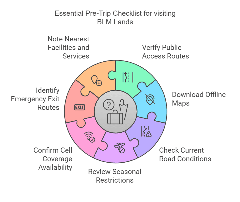
- Verify public access routes
- Download offline maps
- Check current road conditions
- Review seasonal restrictions
- Confirm cell coverage availability
- Identify emergency exit routes
- Note nearest facilities and services
Trip Planning Tools
BLM Official Resources
- National Recreation Site Directory
- Interactive Visitor Maps
- Trail Condition Reports
- Fire Restriction Updates
Local Information Sources
- Field Office Updates
- Area-specific Regulations
- Seasonal Closure Notices
- Emergency Notifications
Safety and Best Practices
Navigation Safety
- Always carry physical maps as backup
- Mark your vehicle’s location before exploring
- Use multiple navigation sources
- Create waypoints for key landmarks
- Share your location plan with others
Communication Preparedness
- Download offline maps before departing
- Bring backup power sources
- Consider a satellite communication device
- Note areas of reliable cell service
- Keep emergency contacts accessible
Conclusion
Embarking on outdoor adventures has never been easier, thanks to the Bureau of Land Management’s extensive resources. The BLM website offers user-friendly tools and detailed maps that guide you straight to public lands near you.
So locate a BLM land for your next hiking, camping, or biking adventure. Respect these beautiful spaces and always adhere to their regulations for a safe and enjoyable experience!
FAQs
What is the Bureau of Land Management (BLM) and what do they manage?
The BLM is a government organization that oversees public lands, including areas for hunting, fishing, shooting, E-Bikes riding, camping sites, and hiking trails.
How can I find BLM land near me for recreational activities?
You can use the BLM’s Geospatial Business Platform Hub, which includes maps like the Annular Solar Eclipse Map in Nevada and the White Mountains map in Alaska to identify BLM lands near you.
Can I get involved with the programs offered by the BLM?
Yes! The bureau organizes various programs such as “Plan Ahead and Play it Safe,” where you are encouraged to participate and also introduce mountain biking or OHVs on Public Lands.
Is it possible to go hunting or fishing on BLM lands?
Definitely! Hunting, Fishing, and Recreational shooting are permitted on most public lands managed by the Bureau, but always be sure to follow Outdoor Ethics guidelines put forth by them.
Are there campgrounds available on these public lands too?
Yes! In fact, there are many different campgrounds listed under their management, like Cobble Rock Campground or Page Springs Campground, along with locations designated specifically for recreational activities like Climbing or Hiking.
Where can I find regulations about using an E-bike on these public lands managed by the bureau?
E-Bikes usage information, along with other regulations specific to outdoor pursuits, is included within each location’s details provided online at the National Operations Center website run by the Bureau.
Leave a Reply