Navigating the wilderness is a crucial skill for any outdoor enthusiast. Whether you’re hiking, camping, or exploring remote areas, knowing how to find your way is essential for safety and enjoyment. This guide will cover the fundamental techniques and tools for wilderness navigation.
Understanding the Basics
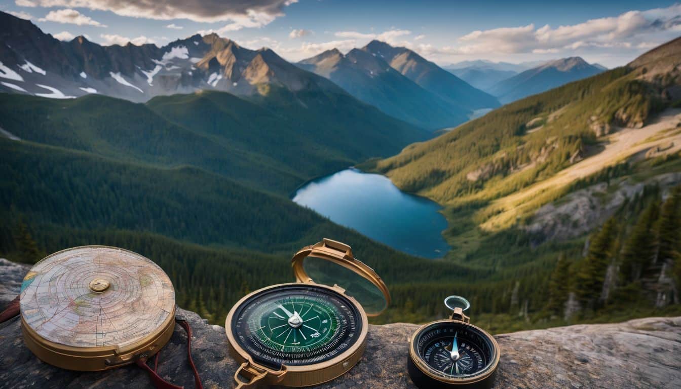
- Map Reading:
- Learn to read topographic maps
- Understand contour lines and map symbols
- Practice orienting the map to your surroundings
Map reading is a fundamental skill in wilderness navigation. Topographic maps provide detailed information about terrain features, elevation changes, and landmarks. Understanding contour lines helps you visualize the three-dimensional landscape on a two-dimensional map. Map symbols represent various features like water sources, trails, and campsites. Regularly practicing map orientation by aligning it with your surroundings helps maintain awareness of your location.
- Compass Use:
- Familiarize yourself with compass parts
- Learn to take and follow bearings
- Understand declination and how to adjust for it
A compass is a reliable navigation tool that doesn’t require batteries. Familiarize yourself with its parts, including the magnetic needle, rotating bezel, and direction of travel arrow. Learning to take and follow bearings allows you to navigate accurately between points. Understanding magnetic declination – the difference between true north and magnetic north – and how to adjust for it is crucial for precise navigation.
- Natural Navigation:
- Use the sun and stars for direction
- Recognize natural indicators like moss growth or tree lean
Natural navigation techniques can be invaluable when other tools are unavailable. The sun’s position can indicate general direction, while stars like the North Star provide consistent reference points at night. Natural indicators such as moss growth (which often favors the shadier north side of trees in the Northern Hemisphere) or the lean of certain trees can offer directional clues, though these should be used in conjunction with other methods for accuracy.
Essential Navigation Tools
- Topographic Maps: Detailed maps showing terrain features
- Compass: A reliable, non-battery dependent tool
- GPS Device: For precise location information
- Altimeter: Helps determine elevation
- Watch: For timing and rough direction finding
These tools form the core of a wilderness navigator’s kit. Topographic maps and compasses are essential and don’t rely on batteries. GPS devices provide precise location data but should be backed up by traditional methods. An altimeter can help confirm your location by matching your elevation to map contours. A simple watch can be used for timing your travel and, in a pinch, for rough direction finding using the sun.
 Navigating Wilderness: Ramban’s Commentary on...
 Navigating the Wilderness: Mastering Handheld GPS...

 Navigating the Wilderness: A Daily Encouragement...
Advanced Techniques
- Triangulation: Using multiple landmarks to pinpoint your location
- Dead Reckoning: Estimating your position based on direction and distance traveled
- Terrain Association: Matching map features to what you see around you
These advanced techniques enhance navigation accuracy. Triangulation involves using bearings from multiple known landmarks to determine your position. Dead reckoning is useful when visibility is poor, allowing you to estimate your location based on your last known position, direction, and distance traveled. Terrain association is the ongoing process of matching the features you see around you with those on your map, helping to confirm your location and route.
Mastering these basic and advanced navigation skills, along with familiarity with essential tools, provides a solid foundation for safe and confident wilderness exploration. Regular practice in various conditions will help refine these skills over time.
If you’re planning a trip with your family, our family camping guide offers additional tips for introducing children to outdoor navigation skills.
Digital Navigation
- GPS Apps: Utilize smartphone apps like Gaia GPS or AllTrails
- Digital Mapping Software: Learn to use programs for route planning
- Satellite Messengers: Devices that can send your location in emergencies
While traditional navigation skills are essential, digital tools can enhance your wilderness experience. GPS apps provide detailed maps and real-time location tracking. Digital mapping software allows for precise route planning before your trip. Satellite messengers offer a safety net in remote areas, allowing you to send your location or call for help in emergencies. However, remember that electronic devices can fail, so always have non-digital backups.
Practical Tips
- Always carry a physical map and compass as backup
- Practice navigation skills in familiar areas before venturing into remote wilderness
- Keep your navigational tools easily accessible
- Regularly check your position and planned route
- Learn to navigate in various weather conditions and at night
These practical tips can significantly improve your navigation success and safety. A physical map and compass are reliable backups that don’t require batteries. Practicing in familiar areas builds confidence and skills before tackling more challenging terrain. Keeping tools accessible ensures you can check your location quickly and frequently. Regular position checks help prevent veering off course. Learning to navigate in different conditions prepares you for unexpected situations.
Safety Considerations
- Always inform someone of your planned route and expected return time
- Carry emergency communication devices
- Be prepared with essential survival gear
- Know how to signal for help if lost
Safety should always be your top priority in the wilderness. Informing someone of your plans provides a safety net if you don’t return on time. Emergency communication devices can be lifesavers in remote areas. Essential survival gear like first aid kits, extra food, and emergency shelters prepare you for unexpected situations. Knowing distress signals and how to make yourself visible to rescuers is crucial if you become lost.
For more information on responsible outdoor practices, check out our guide on eco-friendly camping.
Improving Your Skills
- Take a wilderness navigation course
- Join local orienteering clubs or events
- Practice regularly in different terrains and conditions
- Learn from experienced hikers and guides
Continuous improvement is key to becoming a proficient wilderness navigator. Formal courses provide structured learning and expert instruction. Orienteering events offer practical experience in a controlled environment. Regular practice in varied conditions hones your skills and builds confidence. Learning from experienced outdoors people can provide valuable insights and tips. Remember, navigation is a skill that improves with practice and experience, so take every opportunity to refine your abilities.
Conclusion
By mastering these wilderness navigation techniques, you’ll be better prepared to explore the great outdoors safely and confidently. Remember, navigation is a skill that improves with practice, so get out there and start exploring!
For those new to outdoor adventures, our beginner’s guide to types of camping can help you choose the right camping style to practice your navigation skills.


 Wilderness Navigation: Finding Your Way Using Map,...
 NAVIGATING THROUGH THE WILDERNESS: How I Made it...
 Navigating the Thicket: My Journey Through the...

Leave a Reply